 NGDC for Kenya
Survey Kenya
Type of resources
Topics
Keywords
Contact for the resource
Provided by
Formats
Update frequencies
status
Scale
-
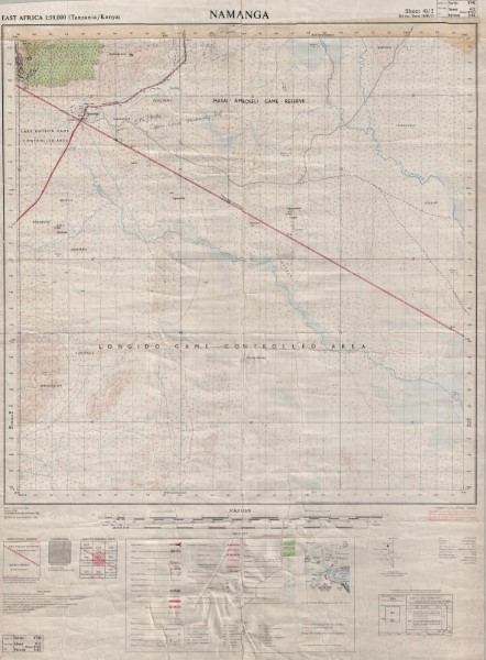
Y742 is a series of 1: 50 000 scale topographic maps which were published between 1963 and 1991. The map series covers the border between Kenya and Tanzania with a number of the maps being published by each government. Several of the maps have been released as a series of versions. The collection held by the Geodata Centre does not include all versions of the maps produced. Publishers: D.O.S. Directorate of \overseas Surveys Tanganyika Government; TSD/OSD Governement of the United Kingdom (Ordnance Survey) for the Government of the United Republic of Tanzania; TSD Ministry of Lands Housing and Urban Development Tanzania; SK Survey Kenya
-
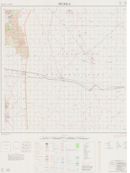
Y742 is a series of 1: 50 000 scale topographic maps which were published between 1963 and 1991. The map series covers the border between Kenya and Tanzania with a number of the maps being published by each government. Several of the maps have been released as a series of versions. The collection held by the Geodata Centre does not include all versions of the maps produced. Publishers: D.O.S. Directorate of \overseas Surveys Tanganyika Government; TSD/OSD Governement of the United Kingdom (Ordnance Survey) for the Government of the United Republic of Tanzania; TSD Ministry of Lands Housing and Urban Development Tanzania; SK Survey Kenya